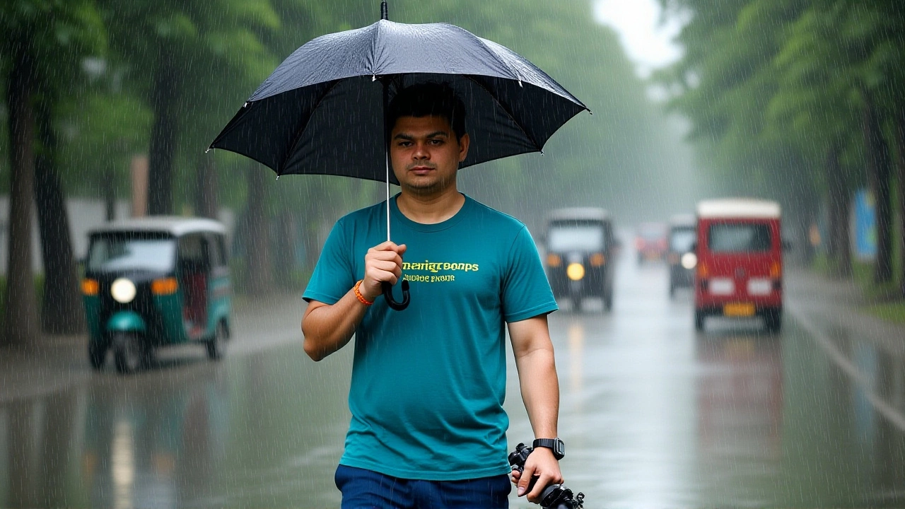
When India Meteorological Department issued a rare red alert for Delhi-NCR on June 12, the message was clear: stay inside or risk your health. Temperatures are soaring to 44°C (111°F), accompanied by dust-laden winds and thunderstorms that have turned the capital region into a pressure cooker.
The warning covers June 12 and 13, with IMD predicting a slight shift in weather patterns by the night of June 13. But until then, residents across northern India are bracing for what experts call "severe heatwave" conditions—a situation where the mercury doesn't just rise; it stays dangerously high, day and night.
A Two-Day Window of Extreme Danger
Here’s the thing about this heatwave: it’s not just hot. It’s oppressive. On June 12, the maximum temperature is expected to hit 44°C, while the minimum won’t drop below 28°C. That means even at night, there’s no relief. Humidity levels will hover around 25%, making the air feel thick and stifling.
But wait—the danger isn’t just the heat. IMD has flagged the possibility of thunderstorms, lightning, and dust storms during these two days. These aren’t minor inconveniences. Dust storms can reduce visibility to near zero, causing traffic accidents. Lightning strikes pose a direct threat to life, especially for those working outdoors.
For June 13, the outlook remains grim but slightly less intense. The orange alert signifies a lower level of severity than the red alert, yet temperatures could still reach 44°C. Winds may gust between 40–50 km/h, bringing some respite through scattered rain. By June 14, however, things start to look up—max temps dropping to around 41°C, with light showers possible.
Why This Matters Now
This isn’t an isolated incident. Northern India has been grappling with extreme heatwaves since May, with states like Rajasthan recording temperatures above 46°C in cities such as Sri Ganganagar, Churu, and Kota. In fact, on May 24 alone, Sri Ganganagar became the hottest place on Earth, clocking in at 46.1°C.
What makes this current spell different? Timing. We’re approaching the monsoon season, which typically brings cooler, wetter weather. Yet here we are, enduring brutal heat just weeks before the rains arrive. Experts say this delay is linked to delayed onset of the southwest monsoon and persistent western disturbances failing to provide adequate cooling.
Turns out, climate change plays a role too. Rising global temperatures mean hotter summers, longer dry spells, and more frequent extreme weather events. A study published earlier this year showed that India experienced its hottest April-May period ever recorded last decade—and trends suggest it’ll only get worse unless action is taken.

Who’s Affected Most?
Not everyone feels the heat equally. Vulnerable groups—including elderly people, children, outdoor workers, and those with pre-existing medical conditions—are at greater risk. Heatstroke, dehydration, and exhaustion become real threats when bodies struggle to cool down naturally.
In urban areas like Delhi, Mumbai, and Kolkata, concrete jungles trap heat, creating “urban heat islands” where nighttime temperatures remain elevated. Rural communities face their own challenges: lack of access to clean drinking water, limited healthcare facilities, and reliance on manual labor under scorching sun.
Meanwhile, agricultural sectors suffer immensely. Crops wilt, soil dries out, and livestock perish without proper shade or hydration. Farmers in Punjab, Haryana, and Uttar Pradesh report significant losses due to prolonged drought-like conditions exacerbated by erratic rainfall patterns.
Expert Insights & Official Guidance
Dr. Naresh Kumar, Scientist F at IMD, emphasized the importance of adhering to safety guidelines during this period. He advised avoiding unnecessary travel between noon and evening hours, staying hydrated, wearing loose cotton clothing, and keeping indoor spaces well-ventilated.
Another key figure, Shri Ranjan Phukan, Scientist D at IMD, highlighted ongoing efforts to monitor weather systems closely. His team uses satellite data, ground stations, and predictive models to issue timely alerts. According to him, early warnings save lives—but they work best when people take them seriously.
Interestingly, Dr. Akhil Srivastava, another senior scientist at IMD, noted similarities between this year’s heatwave and previous ones seen in 2015 and 2018. Those years also witnessed record-breaking temperatures followed by sudden shifts toward monsoonal activity. History suggests similar dynamics might unfold again soon.
Looking Ahead: What Comes Next?
If forecasts hold true, expect gradual improvement starting June 14 onward. Max temperatures should dip closer to 38°C by mid-June, offering much-needed relief. However, humidity levels may increase temporarily, leading to uncomfortable muggy conditions despite lower heat indices.
Further east, regions including Bihar, Jharkhand, West Bengal, Odisha, and Assam continue facing heavy rainfall risks alongside lingering heat effects. Flooding concerns persist in low-lying areas prone to waterlogging, while landslide dangers loom large in hilly terrains like Uttarakhand and Himachal Pradesh.
Southwestern parts of India—including Kerala, Karnataka, and Tamil Nadu—are witnessing initial signs of monsoon arrival. While welcome news for farmers awaiting irrigation, excessive rains bring flood hazards and infrastructure damage risks worth monitoring carefully.
Frequently Asked Questions
How long will the severe heatwave last in North India?
The most intense phase lasts from June 12–13, marked by red/orange alerts. Expect partial relief by June 14 onwards, though residual warmth persists until mid-June. Full normalization depends on timely monsoon onset.
Which states are currently under highest alert status?
Delhi-NCR, Uttar Pradesh, Punjab, Haryana, Rajasthan, and Madhya Pradesh face severe heatwave warnings. Eastern states like Bihar, Jharkhand, and West Bengal deal with combined heat-rain scenarios requiring vigilance against both extremes.
What precautions should individuals take during a red alert?
Avoid outdoor activities between 12 PM–6 PM, drink plenty of fluids, wear breathable fabrics, use sunscreen, and check on vulnerable neighbors. Keep emergency contacts handy and follow local authority instructions strictly.
Is climate change contributing to these extreme weather events?
Yes, scientists link rising global temperatures to increased frequency/intensity of heatwaves. Delayed monsoons, altered jet streams, and oceanic anomalies amplify regional impacts. Long-term adaptation strategies remain critical for resilience building.
Will agriculture recover quickly after this heatwave ends?
Recovery varies based on crop type, irrigation availability, and post-heat rainfall distribution. Early sown crops likely sustain moderate damage, whereas late-planted varieties stand better chances if moisture returns promptly. Government aid programs often assist affected farmers financially.
Are schools/offices closing due to the heatwave?
Decisions vary locally depending on district-level assessments. Some districts declare holidays for schools/kindergartens during peak heat periods. Offices generally operate normally unless power grids fail or commuting becomes unsafe. Always verify updates via official channels.